Provision of High-Precision 3D data
For Autonomous Driving including Automated Driver Assistance Systems (ADAS)
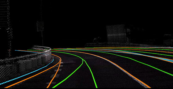
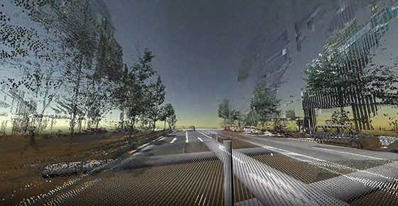
While meeting the requirements of 10 Japanese automobile manufacturers, the data contains both real road features (e.g.traffic signs and carriageway marking) and virtual road features (e.g.lane node linkage which are indicated virtually) necessary for the autonomous driving systems.
For a variety of applications, including the maintenance of social infrastructure
Mobile mapping systems (vehicles equipped with GPS, cameras, laser scanners, IMUs, etc.) using Japan's most advanced and sophisticated surveying technology are used to measure highways and expressways throughout Japan.
With this HD Map,
cars drive into the future.
To the next generation of High-Precision 3D Map data (HD maps)
To contribute to fast-evolving advanced driver assistance systems and autonomous driving
For the future mobile society that transcends borders and the conventional thinking
To contribute to fast-evolving advanced driver assistance systems and autonomous driving
For the future mobile society that transcends borders and the conventional thinking